Saturday, April 30, 2022

April 30 - May 1; Through Current Cut and on to the Abacos

The currents through Current Cut are very swift so timing the passage to have the current with you, and not against strong winds is important.  Today, we would be westbound through the cut so the prevailing east winds would be lining up in the right direction.  Also the current was to be in the westerly direction from 10AM to 4PM so we had lots of cushion with the timing. It was another beautifully sunny day as we sailed sailed southeast and arrived at the Current Cut about 11am. The pass through was easy with a maximum of 4 knots of current.  After clearing the cut we headed up in the lee of the western shore. The water remained typically blue and clear and the western shore gave us a gentle breeze without any waves for a quiet anchorage. 


Headed through Current Cut


The settlement of Current is a quiet community that we quite enjoyed visiting last time. This year though we decided to just enjoy the afternoon on Juno and also kept an eye on the storm clouds to the east. The storm wasn't headed directly towards us but was creeping closer as it moved south.  After a couple of hours the storm began to pull the winds around from the southeast, to northeast, to north, and eventually northwest.  Now instead of the western shore offering shelter we had winds increasing from the opposite direction causing the seas to build.  The wind did get to 15 for a while but mostly stayed under that. This still gave us a constant bouncing as the waves, having built from 6 miles to the northwest, passed by. This wave action continued through the evening until sometime in the middle of the night it quieted down and Juno was sitting calmly to her anchor when we woke in the morning to continue on to The Abacos, the last segment for us in the Bahamas.

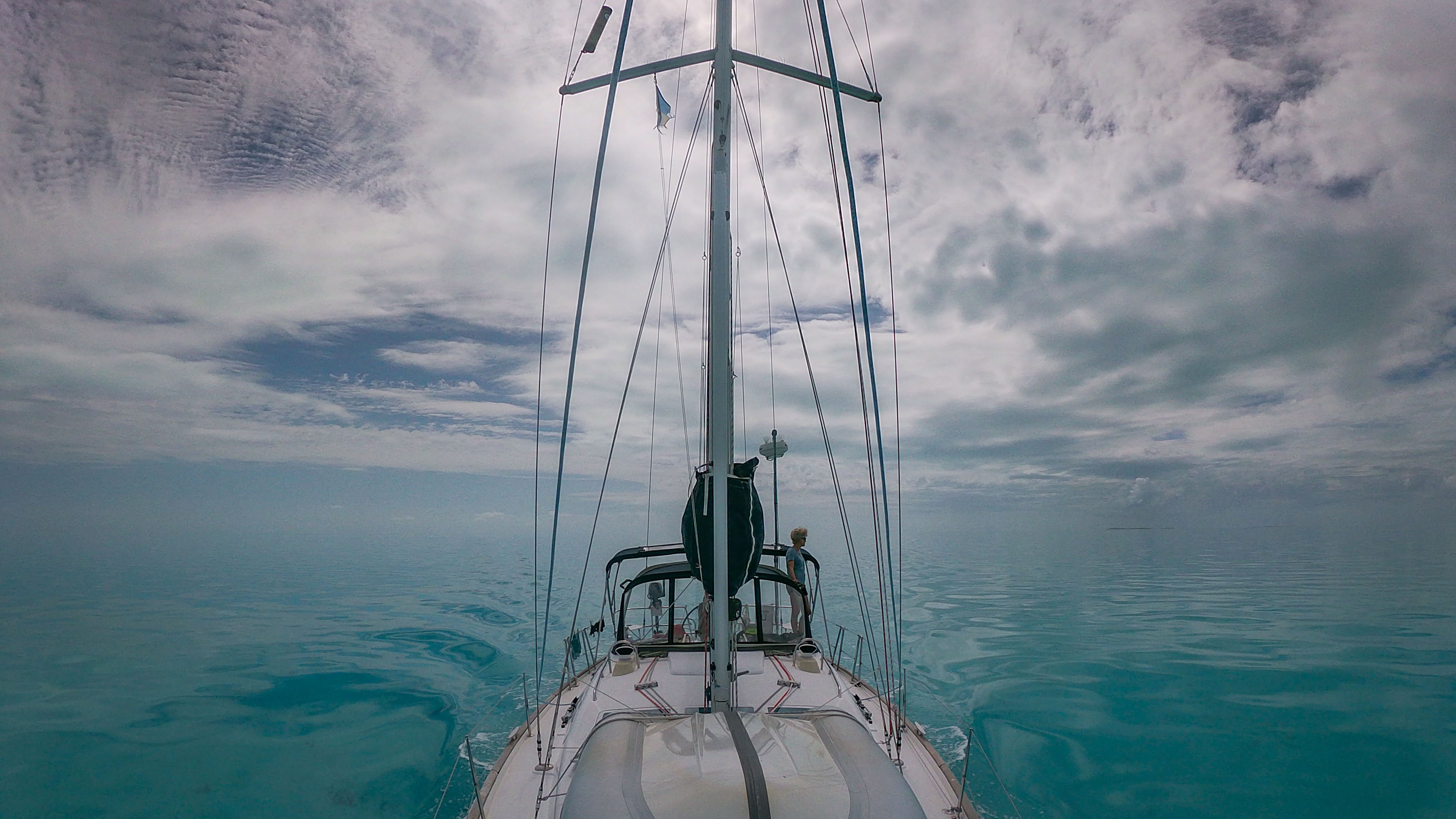
We had two different forecasts for this 50 mile journey. Both were for easterly winds and we were headed north so that was great. However one said winds would be light enough that we would have to motor, or motor-sail, most of the way to make it before dark. The other was for very strong winds that would mean an uncomfortable sail.  The former looked like the most likely so we decided if the wind in morning was not on the strong side, we would head out for two hours and if the winds stayed to light to reach the cut at the Abacos, we would turn around and wait for the next day, chalking it up to a nice day-sail. As it turned out the winds were between the two forecasts and we were able to sail comfortably the entire way. 

Harry had his fishing lure out, and as in 2019, about half way to first Abacos island there were large amounts of sargasum weed which, as in 2019, kept snagging on Harry's lure. So Harry brought in the line and lure, defeated again. In the last eight miles the weed became almost non-existent so Harry deployed his lure for one last attempt. After about 30 minutes a Mahi bit.  Sarah slowed the boat some and helped Harry get his gear together - gloves, lifejacket, knife for cutting the line loose if Harry or Sarah got tangled in it, and a few other items.  With his gloves and lifejacket he pulled the Mahi towards Juno. The fish began to tire and as Harry got it closer he realized it was a smaller female.  So he brought it aboard with the intention of releasing it, but once it was in the cockpit it had already expired, and one eye had been injured, perhaps by the hook. So with that, Harry continued with the filleting process giving us fresh Mahi for two substantial meals.


Mahi #2

By the time Harry was done putting the fishing gear way and cleaning up, we were only a few miles from the Little Harbour cut.   The current, as planned, was in the right direction for the cut so we steered in with Sarah keeping an eye on our track on the iPad while Harry steered. Having cleared the reef and breakers, we headed north and found a quiet anchorage behind Lynyard Cay where Sarah prepared our Mahi with a light Panko breadcrumb topping.


Sarah finishes securing the anchor for the night at Lynyard Cay


It's Miller time! (Technically Sierra Nevada time)


Fresh Mahi!


Friday, April 29, 2022

April 29 You Can’t Get There From Here (Easily): Our Harbour Island Excursion

 Harbour Island Eleuthra ranks right up there as a challenging place for sailboats to reach. Unlike the Jumentos & Ragged Islands which took us an extra day coming and going to reach because we had to sail 20 miles east then right back 20 miles west, in order to reach Harbour Island by boat, one has to first cross the “Devil’s Backbone” a short by comparison 2.5 miles of shallow reefs with “numerous coral heads” lurking just below the water’s surface. The inexperienced sailor is advised to hire a local captain for the day to make this passage along the northern tip of Eleuthra from Spanish Wells eastward, and not to make a go of it alone, as there are numerous tales of boats running aground or worse. Additionally even experienced captains are advised only make this trip with the sun overhead (to better see the coral heads) and only in settled weather. 

Well, Captain Harry was pretty confident that we could save the $100 plus dollars for a captain and make a go of crossing over the Devil’s Backbone alone, provided the weather was calm and sunny. We were ready to position Juno near Spanish Wells for this adventure. However, the weather forecasts were not cooperating as squalls were forecast for the next several days. Additionally, assuming we could cross the Devil’s Backbone and escape any major catastrophes, we’d have to cross back over the reef stricken backbone a second time on our return trip from Harbour Island else exit by way of a narrow shallow cut southeast of Harbour Island which presented unique challenges of its own. Faced with these realities, our enthusiasm for taking Juno to Harbour Island waned. We looked into buying tickets to take the mailboat that runs Fri-Sunday, weather permitting, but our inquiry suggested that they were cancelling this run on account of the weather. 

Persisting in finding a workable methods of getting to Harbour Island by the land route, we found we would have to taxi or hitch hike about 15 miles past the airport to the site of a water taxi for a 10 minute, and only $5 ride to Harbour Island.  This option sounded preferable best undertaken today when the squall chances were the lowest. Ironically, as the crow flies, Harbour Island is only about 3.5 miles north of our current anchorage at the Queen’s Baths. 

So after breakfast, we laid down more chain on our anchor to absorb any high winds should a squall hit while we were gone for the day and started hitch hiking figuring we’d call a cab if we didn’t get a ride within 30 min. There wasn’t a lot of traffic but within 5 minutes, a pickup truck stopped to pick us up and off we went. Shortly thereafter, we stopped to pickup another hitchhiker going to the airport where our free ride ended. We tipped out driver then set out on foot to walk the 1.3 miles to the water taxi, getting another lift right to the water taxi that took off as soon as we got on board. 

The water taxi sat about 12 passengers, many of whom were either employees of the resorts on clients of the resorts on the island. The island was originally the capital of the Bahamas and was settled by loyalists in the late 1700’s. It is described as having New England-like cottages, but it’s best asset, is a 3 mile long white sandy beach protected from the ocean swells by a reef. We visited the government office to mail three letters we’d been waiting to post for nearly a month, walked a portion of the beach, took a swim, enjoyed a tasty lunch outdoors at the Coral Sands Resort overlooking the beach, then walked back through the little town, and took the water taxi back to the mainland followed by a land taxi back to Juno. 

We found Juno had escaped the rain showers we had seen earlier popping up on the radar, and as it was warm, sunny and calm, we each spent an hour in the water cleaning the scum off the bottom of Juno, getting out just before the rains arrived around 5:00 pm. Still full from our lunch, the cook got an easy night preparing a salad for dinner. Afterward, it was time for baking a loaf of bread which rose in the oven so much that the loaf sealed the lid closed and requiring the two of us to pry the lid loose. 

In the end, we were glad we had visited Harbour Island as it was a pretty place. A fair number of American tourists were there like Nassau, but it didn’t exude wealth and extravagance or Vegas the way Paradise Island does. It was also nice because the locals were around. We saw school kids in the streets, fishermen cleaning their catch of barracuda, and men native men hanging out in the shade of trees by the docks. 


Catching a ride to Harbour Island Ferry


Harbour Island cottage


Local fisherman getting a Barracuda ready for sale


Thursday, April 28, 2022

April 28 Two Natural Wonders on Eleuthra: Queen’s Baths and the Glass Window

 After motoring 20 miles northeast from Finley Cay as there was too little wind to sail, we arrived at the northeast portion of Eleuthra around lunch time. We revisited the two natural wonders timing our visits to correspond with the optimal tidal phases for each. The Queen’s Baths are best experienced at low tide. Our anchorage was in an optimal location as we merely had to walk 30 yards from the shore towards and across the Queen’s Highway, then another 30 yards to the east to her baths and the open Atlantic.  The baths are depressions in the coastal rock worn smooth by the constant wave and swell action from the Atlantic Ocean. There were about five pools at various setbacks from the ocean ranging in depth from one to five feet deep. Small fish, crabs, and sea urchins were common in the pools so we had to be a bit careful, but once in the deepest pool, it was just a matter of time before the next large swell would splash up and over the rocks, bringing with it gallons of fresh ocean water and lots of bubbles to add to our bath.  In addition, a little further along where the ocean met the rocky shore, it was mesmerizing simply watching cascades of water rising 20 feet into the air with the larger swells, and added to this was a thunderous sound. The experience was akin to watching a fireworks display.

The other natural wonder- The Glass Window- was a five minute dinghy ride from our anchorage. Unlike the baths, this natural wonder however is best viewed and experienced  from the calm waters to the west. Here Eleuthra is nearly bisected into a north and southern island as the elevation is only a few feet above sea level. This low point of the island in fact has a bridge spanning this depression and at high tide, the Atlantic surge coming from the east dramatically crashes upon the eastern shore sending cascades of water over the rocks to the calm waters of the west shore of Eleuthra. From our vantage point in our dinghy on the western shore of Eleuthra, we sat with great anticipation for each dramatic ocean surge, again much like the joy in waiting for and watching a fireworks display.


Seas breaking over into the pools of the Queen's Baths


The Glass Window


Wednesday, April 27, 2022

April 27 - Overnight at the edge of a sand bank and our drone goes walk-about

Eleuthera Island a wide open bight to the south-west however there is a sandbank that stretches across almost the entire area requiring you cross in deeper water at the southern end, or go around the end of the bank far to the north. If we had taken the overnight, single leg approach, we would have crossed at the south. However from the north end of the Exumas we needed to cross an area with coral heads and shallow waters to get around the sand banks to the north.  The wind was E at 12-15 and the sun was shining brightly making for superb day of sailing.  The first couple of hours were simple straight line sailing, then we arrived at the area of the coral heads.  Fortunately on a sunny day like this they stand out as black patches against the bright aqua blue of the water around them so picking your way through them is easy as long as you keep an eye out. The only tricky bit is that there were some clouds and their shadows look a lot like patches of coral.  By keeping an eye out, and checking the sky, you have enough warning to know whether the dark patch is cloud or coral. At their densest the spacing between these coral patches was 50 to 100 yards, so with small adjustments to the autopilot we passed easily through them. We contemplated stopping to snorkel one of the patches but thought it better to keep moving.

After getting past the coral patches there is a small cay in the middle of the northern end of the sand banks.  Since we didn't stop to snorkel the coral patches en route, we had time to go investigate this lone cay - Finely Cay.  We couldn't get Juno much closer than 2 miles from the cay but by now the wind had dropped to nearly zero so we anchored her in the surrounding deep sand in 7 feet of water, loaded up the dinghy including our small drone, and headed to Finely Cay.

Finely is only 800 x 200 yards so exploring it was quick.  There is a pretty sandy beach on the SW side so we landed the dingy there and wandered up and down the short beach to see if there were any paths to the other side. Not finding any we decided to try our drone. Where is all the drone footage from this trip you ask? Well, our little Tello drone doesn't have a lot of power so we have been waiting for a calm day to fly it. It doesn't have a GPS but instead uses its camera to visually track where it is. The range is also limited so it can't get too far from the device controlling it on the ground. Harry set it up and connected it to the iPad and up it went.  We could get a better look at the cay and then sent it out a bit over the water to get a picture of us on the beach. Then the control app "Vision Positioning Unavailable, Land as soon as possible." popped up. Uh-oh.  The video tells the story. Needless to say we did recover it undamaged as we have the video.

After that excitement, we took the dingy for a circumnavigation of Finely Cay. Not finding much interesting to snorkel or explore elsewhere we headed back to Juno.  The winds were still very light and forecast to remain so until well into tomorrow so instead of continuing on to Eleuthera proper, we decided to spend the night, more or less, in the middle of the ocean.  We went for a swim and took the opportunity to give Juno's hull a long overdue scrubbing to remove accumulated growth. We had not made this a priority so now the job was much bigger. Without SCUBA, doing the job with mask and snorkel one tires pretty quickly. We both gave it a good effort and committed to continuing the job at future anchorages when the seas were calm.


Dodging coral heads


Relaxing after the coral heads


Juno anchored a mile off Finley Cay

Tuesday, April 26, 2022

April 24-26 - Hop, skip, and a jump to Eleuthra

Our time in the Jumentos combined with staying in George Town for the Sloop regatta and waiting for favorable winds meant we need to move quickly up to the Abacos with a short stop in Eleuthera.  We thought we would make a couple of hops through the Exuma chain, then head over to Eleuthra at the northern end.  However, since we weren't going to spend more time exploring the Exumas, a more efficient route would be to sail overnight straight to Eleuthra. To avoid adverse currents and to not arrive after dark at Eleuthera we needed to leave George Town at 7PM.  The winds had been blowing 20-25 for the last several days but were forecast to ease up on Sunday so that seemed like a reasonable trip. We still had all day before a 7PM departure and wanted to explore Stocking Island a bit more. We went for an short early morning walk, then spent some time before lunch getting Juno ready to leave that evening. After lunch we struck out for one more cross island walk to see the ocean side one last time, and for Sarah to collect some more palm fronds. It was beautiful to see the swells breaking dramatically against the shore - except that we would be sailing in those conditions later that  night.  We knew the swells were more pronounced as the came ashore but there were still a lot of white caps offshore - so we decided to stay put tonight. Winds were forecast to be strong again tomorrow night, sigh.  So, back to plan A and leave the next morning and hop up the Exuma chain.

We left at 8AM. The wind was 15 out of the east with the swells relaxing a bit.  We set our sights on Black Point, 50 miles to the north. We know the cut at Black Point, Dotham Cut,  and we should reach it just in time before the tides switched against the wind after which crossing the cut would be "more exciting".  Around noon we heard over the VHF radio another boat that left George Town an hour before us and that was also heading to Black Point, announce they were entering Galliot Cut which is 15 miles before Black Point.  This would be good for us too on a several fronts 1) It gets us onto the Exuma Banks and in the protection of the Exuma island chain sooner; 2) we would be entering in the middle of the favorable tide and not need to worry about having current against wind at Dotham if we were late; and 3) we had already avoided two squalls but a third on the horizon looked like it might get us and we would be in the more settled waters of the banks with 1'-2' waves instead of ocean size 6'-8' swells, likely bigger in the squall. So we diverted to Galliot Cut. Once back on the banks, we did get the squall but as anticipated it was quite easy to deal with. We just put away the genoa and waited below with the autopilot keeping us on track as the wind and rain blew through.  We were ahead of schedule so we passed by Black Point and anchored 6 miles further up the Exuma chain at Staniel Cay.

The next morning we set off and sailed to Highbourne Cay. We arrived at 4:30P and went for a quick snorkel at a reef we visited our our trip in 2019, then found a quiet anchorage away from the the other boats that also offered settled conditions for a quiet night.  The next morning we set off in light winds to cross a new area full of coral heads but we would be at Eleuthra Island.


Tracking the squall while staying dry below


Saturday, April 23, 2022

April 21-23 The Bahamas National Family Island Regatta

Once we decided to spend a week down in the Jumentos, we knew that we could be in George Town for the Bahamian Sloop regatta. We first learned of these boats on an episode of a television show called Distant Shores. The annual regatta was started in 1954. The sailors come from the many islands in the Bahamas though today the majority come from Nassau. All the islands are extremely proud of the sailors that are go to represent them.  

The boats are based on traditional fishing boats used by local fisherman for 150 years. They have enormous sails for the size of the boat with the boom extend far past the back end of the boat.  To support the large sails against the wind the crew have long planks that extend out from one side of the boat and up to 4 people, on the largest boats, sit out on the planks balance against the wind.

For us and our many of our friends that race sailboats, the most obvious difference from our racing is the method of starting.  In most sailboat races the crew are given a count down of five minutes and have to sail their boats but remain behind a line made up of the race committee boat and a buoy.  In the Bahamian Sloop racing there is a starting line indicated by two buoys, but the boats throw out an anchor to maintain their position on the line and from what we could tell it was okay if some of the boat was a bit over the starting line as long as not egregiously so. They boats have their sails down waiting for the start signal. When the gun goes off half the crew pulls forward on the anchor line to propel the boat forward and build speed. The other half of the crew begins hoisting the sail.  It is extremely exciting to watch and I wonder if the Americas Cup couldn't benefit from something similar. The boats the race around several buoys that make up the course.

We ventured out in our dinghy to get some close up views of the racing.  We are so glad we were able to be in George Town for this. Next time we will plan better and try to participate as apparently many teams are open to adding a guest crew.


A documentary on the races


15 seconds to the start


And they are off, pulling forward on the anchor line ...


while other crew are getting the sail hoisted even as they are racing


Beautiful sloops coming down to a close finish


Wednesday, April 20, 2022

April 18-20 Returning to George Town, again

The squally weather continued with a few coming through last night as we were anchored at Flamingo Cay but by this morning (Monday) the skies were clearing though the winds were a bit light for sails alone.  So we hoisted the main and rolled out the jib, and reluctantly took some assist from the engine to keep us moving.  There are times when moving slowly along under sail alone is just want you want to do. Today wasn't one of those times. We had to go about 50 miles and be at our destination before dark to anchor.  At six knots this was at best eight hours - north four hours to the Comer Channel; two hours to transit the Comer; and transit it for another two hours to get back to Thompsons Bay for the night.  

We were able to sail or motor sail for the first leg north but the light easterly winds forced us to take down both sails and just motor through the Comer.  With light, to sometimes non-existent wind, the waters in the Comer were very calm so that we could easily see the sea fans and star fish on the white sandy bottom 7-8 feet below us. The calm water also gave an unsettling feeling the the water was much more shallow than it actually was.  Having recorded our track through the first time through the Comer we had a lot of confidence on the return trip so we just enjoyed the beauty of the aqua waters as Juno glided along.  We exited the east end of the Comer and continued two more hours under engine to Thompson's Bay where we dropped the anchor for sundowner G&Ts and dinner.


One of many starfish visibile in 8' of water


No wind crossing the Comer Passage

From a distance the squalls are beautiful

Tuesday at 5AM another squall with lightning came through, so we ran through the drill of putting our valuable electronics in the microwave.  After it blew through we managed to sleep for another hour or so.  We had planned to set off first thing but there were still squalls in the area so we took the opportunity to finish few a chores. After the skies cleared we set off under power but the NE winds filled in and before long we were sailing! We returned to George Town (Elizabeth) Harbour. With the NE winds forecast to continue to build we went back to an earlier anchorage under the protection of Elizabeth Island, that at least for the time being, we had all to ourselves.


More squalls in the distance as we prepare to leave Tompson's Bay
 

Wednesday AM we found a boat had come in during the night and anchored in the area. Before long another 5 showed up, all part of a group of solo-sailors that had just sailed back from the northern end of Long Island.  The day was forecast to be rainy and very windy so we stayed put took the downtime to catch up on odds and ends. Sometimes that is as exciting as it gets.


Sunday, April 17, 2022

April 17th Racing Northward Ahead of Tomorrow’s Calm: Flamingo Cay, Jumentos

This morning winds were a pleasant 10-15 knots ESE although skies were a little overcast. We knew we had a lot of distance we wanted to cover, particularly given that our travels were cut short yesterday and the forecast for Monday and Tuesday was to be light (0-10 knots) and variable followed by a definite NE breeze - precisely the direction we ultimately needed to head to get to Thompson’s Bay, Long Island. Not wanting to motor more than we had to, we hauled anchor at 7:30 am soon after the sun rose and raised both the main and jib, all the while keeping an eye on the horizon for squalls. We got a rain shower shortly after leaving Raccoon Cay but otherwise we stayed dry for our sail, and after lunch, the sun was shining all around. We wanted to reach the northern end of the Jumentos which would be Water Cay but as we had made one stop there when heading south, we decided to make a quick stop first at Flamingo Cay to check it out. We dropped anchor around 2:30 pm, put the dinghy in the water, and found a large cave that we could enter while in our dinghy. The cave had a hole or two in the ceiling so one could see daylight shining through. We were unsuccessful in locating any coral heads to snorkel so we walked to the top of the hill through the dense brush and got a view of the northern end of the cay where a bight is located that would make for a nice protected anchorage next time we come here. 

Back at the beach, we found pieces of a sizable sailboat - boom, bow, and sail remnants- strewn about the beach. We hoped it wasn’t an omen of things to come but served as a reminder of just how rugged and removed from any assistance one is should help be needed. Sarah went for a quick swim off the beach finding additional boat parts on the bottom and together we decided to stay the night at Flamingo Cay rather than push on to Water Cay. 


Cave from the outside


Some of the inside showing the openings in the ceiling


Beautiful palms along the path up the small hill


Checking on Juno part way up


The view from the top


The bow of the mystery boat


We never get tired of the beautiful sunsets


Saturday, April 16, 2022

April 16 - A Big Low Point as We Run into a Squall: Racoon Cay Again

Our plan for the Jumentos trip was to return to George Town Thursday afternoon in time for the beginning of the Bahamian Sloop National Regatta. We also looked forward to stopping at Buena Vista Cay near Raccoon one night, and a stop at Flamingo Cay one night with a little time to enjoy each. Those plans were based on a 10 day weather forecast from five days ago so naturally changes are not unexpected. The change this time is that a strong east wind is to arrive sooner than the forecast which meant we needed to get out of the Jumentos and back to the George Town by Tuesday. No problem, we just needed to head north a few days sooner. Leaving today we could still get short visits to Buena Vista and Flamingo, so we headed north from Hog Cay at 8AM with the jib and main up and the winds out of east at about 12mph.  The skies were overcast and looking a bit dark to the northeast but we have seen plenty of these passing showers in the Bahamas, so no problem.

About an hour into the trip, as were approaching Raccoon Cay, the skies started looking even darker. Harry had been using our radar to track the rain cells and so far they were passing ahead or behind us.  But now, the one on the horizon looked like it was going to give us a good soaking. Then we saw a bolt of lightning off in the distance. Counting one-mississippi, we judged that this bolt was 2-3 miles away. It is rare for lightning to strike a sailboat but it does happen. 99% of the time it doesn't damage the integrity of the hull but it almost always fries all the electronics.  Since we were familiar with Raccoon Cay and it was just two miles to the east it was an easy decision to put away the sails and motor over to wait out the squall. In addition to being familiar with Raccoon, we knew it had high hills that would both help to block any squall related winds, and that might be more of an attraction to lightning than our shorter metal mast.  


This looks like a squall worth stopping for

 When there is lightning we put all of our most important electronics  (phone, tablet, laptop, handheld radio, satellite communicator, etc) into the unplugged microwave that acts as a faraday cage to avoid the pulse from a nearby lightning strike from damaging them.

By 11AM we were settled with the sky darkening and the lightning now less than a mile away. Once this blew through we could continue on our way.  Then came the rain with wind increasing to a steady 20 with higher gusts. Suddenly it started raining even harder and the wind continued to increase. We had our instruments off but estimate that the gusts were at least 40mph. The biggest gusts would swing Juno around and cause her to heel over more than one usually experiences on anchor.  This continued for an hour where every five minutes or so another big blast of wind would come through.  The lightning got closer but we never heard any close by. After an hour of this the worst of the storm moved through but the winds were still 20-30 mph with lots of rain.  This one was over but it was clear that there were more coming so we settled down to wait until tomorrow to continue on.


Sunset after the last of the squalls passed through


Friday, April 15, 2022

April 14-15 More Highs and Lows in the Raggeds: Hog Cay

We spent a few hours on Thursday morning exploring the beach at Raccoon Cay, Loyalist ruins, and tracking down a blue hole which turned out to be green and not blue while hearing the bleating of goats (the only island inhabitants) in the brush but never actually seeing any.  

We had previously been advised that Hog Cay was the gathering place for cruisers in the Ragged Islands  - with walking trails, a nice beach, and a social scene, and as we were only about 8 miles from Hog Cay, we  pointed our bow SE and set off after a late lunch. Around 5:30 pm. We pulled into the anchorage and joined the twelve other sailboats in the anchorage, setting down our anchor, by chance, next to Will and Sherry who we had met four days earlier at Tiny’s Hurricane Hole at Thompson’s Bay, LI. We then placed the dinghy in the water to get ashore to the tiki hut/Hog Cay Yacht Club where Will & Sherry, and four other cruisers were having sundowners and where we picked their brains for information on the island’s hiking trails for tomorrow. The rafters of the Hog Cay Yacht Club were colorfully decorated with the homemade boats signs from passing cruisers, including one from SV Delos-(Brian, Karin & Sierra) a favorite YouTube cruising couple.

After a great night sleep with no swells, on Friday morning under sunny skies we set off on a cross island hiking trail with a picnic lunch. The trail just to the north of the Yacht Club took us up a ridge where we had water views of the anchorage to the west, a salt pond to the north, ocean waves to the east, and Ragged Island to our south. The trail was easy to find as it was well marked with plastic debris - mostly flip flops and shoes. After traversing the 0.5 miles to the eastern shore of Hog Cay, we went down to the beach/plastic collection area to find items that we could repurpose in making our boat sign to be added and displayed at the Hog Cay Yacht Club which is exactly what we did Friday afternoon after first enjoying our picnic lunch overlooking the breaking surf. 

With our homemade Juno sign in hand, we returned to the Yacht Club where we added it to the many others decorating the rafters, then hunted down dried wood from the scrub brush for a fire later that evening after dinner. About 25 people representing about 6 -8 boats, most with children, were gathered and sharing in a potluck supper when we returned with wood in hand and we mentioned that they were invited to join the bonfire we’d be starting around 8:30 pm when the skies grew dark enough. So we returned to Juno for our dinner and saw a bonfire already burning on the beach around 7:30 pm. We weren’t sure what wood would be remaining when we showed up at 8:30 pm and were pleased to see our wood pile untouched as someone had lit a bag of trash on fire. Sadly, this trash contained beer cans, aluminum, and a lot of plastic and it was still burning even though the young families had departed and the yacht club was now occupied by a small group of French sailors who had arrived earlier in the day. We spoke to two young boys in French who seemed to be tending the fire and informed them that it wasn’t right to burn plastic garbage there on the scenic beach, that the fire pit was only for wood and paper. Their parents soon called the boys to leave for the night and now Harry and I had the beach to ourselves as we started a separate wood only fire to roast our marshmallows for s’mores. The evening left a sour note in our otherwise perfect day at Hog Cay.


The path to the blue hole on Raccoon Cay


Looking across the blue hole


A few of the hiking paths on Hog Cay


The ocean side of Hog Cay


Making our way back on the bay side


New friends Will and Sheri at the Hog Cay Yacht Club


Leaving our mark at the Hog Cay Yacht Club


Wednesday, April 13, 2022

April 13th Jumentos & Ragged Islands: The Lows (Water Cay) and Pleasant Highs (Raccoon Cay)

 With winds continuing through the night 18-23 knots or more out of the NE, we had ocean swells (surge) most of the night last night rocking Juno from side to side while anchored at Water Cay close to a cut. It may sound romantic to be rocked to sleep by small waves and it usually is, but ocean swells, even diminished by they time they reached Juno, aren’t the types of waves that are conducive to sleep, especially when our v-berth is atop one of our two water tanks so we also have the added sounds of water sloshing in addition to the winds blowing through the rigging and the rocking side to side. Suffice to say, we didn’t have one of our better nights last night. But Water Cay gave us our first taste of the remoteness of the Jumentos as, aside from one local fishing boat that came nearby to clean their catch, we were the only boat around with miles and miles of water to our west and an uninhabited cay to the east. We were warned about swimming at Water Cay as the bull sharks are attracted to the fish scraps and it was just as well we moved on since the winds on Wednesday we’re good for making distance southward (18-23 plus knots ENE). 


Typical squall on the horizon

Sailing southward, we were protected from the ocean swells by the numerous cays we passed, some of which were nothing more than large rocks. But when we would pass by the cuts, the swells and waves would increase dramatically 5-7 feet and it felt like a washing machine as they were coming from multiple directions. We set our sights on stopping at Racoon Cay - about 35 miles south of Water Cay and part of the chain of islands referred to as the Ragged Islands. After about 6 hours of sailing, we encountered several passing showers and we saw only four other boats while underway, until we rounded a turn for Raccoon Cay where we saw four boats on anchor, the largest of which was Ultima Novia, the yacht on which good friends of Sarah’s eldest brother, Dave and Wan Grabb, were cruising for a week. Once we got our anchor set for the night, we radioed Ultima Novia and received a most generous invitation to join them and their party for dinner which we graciously accepted. However, as it would have taken us some effort to take our dinghy off Juno’ s decks where we tie it securely for longer passages, and put the outboard engine on, we called them back to see if it was possible for them to pick us up for dinner as their tender was already in the water. They obliged and just after the skies burst forth with a rain shower, Dave and Jon (the captain) arrived in their tender to transport us back to Ultima Novia. We arrived three minutes later, all wet from the rain, where we were offered dry towels and introduced to the party and crew.

Richard, Stacey, Karen, Bobby, and Dave and Wan made up the owner’s party of six, while Jon the yacht’s captain, Cara the hostess, and Lauren the chef tended to everyone’s needs throughout the evening. All of the guests onboard were friends as a result of having raised children in Boulder, CO, and Richard, Dave, Cara and Sarah each shared ties to Michigan. We received a tour of the yacht before dinner and enjoyed wonderful conversation and the best three course dinner we’ve eaten in months before we were returned to back to Juno for the night with the best memories to savor as we settled in for a more settled evening with only modest surge.


The captain bringing us to the 131' Ultima Novia.


The owners and their guests before dinner


Tuesday, April 12, 2022

April 10-12. An Unexpected Change of Plans: Heading South Once Again

Last night we started to plan a rough itinerary to start working our way north when Harry had the thought that maybe we should try to get to the Jumentos and Ragged Islands.  The Jumentos and Raggeds are a long chain of rocks and islands that start 30 miles, as the tropic bird flies, south of Great Exuma and George Town. The Jumentos starts in the north and stretch about 35 miles to a six mile gap open to the ocean, after which the Ragged Islands begin. While 30 miles isn't a great distance, the difficulty of getting there (not being a tropic bird), and to a larger degree getting back; coupled with the fact that the only inhabitants, a total 70, are in Duncan Town at the southern most of the Raggeds, not many cruisers venture there.  We had a goal of visiting some of the more remote islands this trip, so this seemed like our last opportunity. This morning, after talking to a couple local cruisers to clear up some questions on the route, we decide to go for it.  

While it would be nice to say that we sailed straight to the first of the Jumento Cays, nothing is that simple.  The route we have to take requires us to take one day to sail 40 miles ESE back to Thompson's Bay on Long Island, then another day sailing W for 24 miles to cross the Comer Channel, then head south for another 24 miles to arrive at our first Jumento - Water Cay. And would would have to follow that same route to get back at the end of the trip.


Thompsons Bay - We left Sunday morning about 11 and with NNE wind of 15 knots, enabling us to sail the entire way to Thompson's Bay. We arrived at 4:30 and Sarah suggested we head to Tiny's Hurricane Hole, a known sailor's hangout, for a drink but also to meet up with some other cruisers that might have more input for us on the Jumentos. This was spot on as we met Will and Sheri on the Contana catamaran "BillyK" who had lots of previous experience in the Jumentos and were headed there themselves. After plying them with questions it was starting to get a little dark so we headed back to Juno, deciding to spend another day and night before striking out. The next morning while getting ready for the day Sarah noticed that a man with two dogs in a dinghy was having engine problems.  Harry got in our dinghy and zipped over to tow him back to his boat.  He said he wasn't worried and had a radio to call for help, but was grateful nonetheless for a tow back to his Tayana 38 sailboat, Spirit. Having done our good deed for the day, we were prepping to head to town when another dinghy stopped by. This was Erin and Cara on an Island Packet 38, Vela. They were taking it on themselves to restart a Monday tradition in Thomnpson Bay for the cruisers to meet on the beach at 5:00 for sun-downers and to socialize. With that on our schedule for the day, we headed to Salt Pond.  This trip ashore to the settlement of Salt Pond was much more brief as it really just gave us a chance to stretch our legs and maybe pick up a couple of things at the market. Finishing that we returned to Juno to mix up our PiƱa Coladas, and head to Cruisers Beach. There we met sailors from 5 other sailboats. It is always interesting to hear of others trips to get ideas for future adventures. The social dimension is also welcome as much of the trip is spent with just the two of us either on Juno or off exploring an island.


Gathering on Thompson's Bay with other cruisers

Tuesday morning we were ready to head to Water Cay, the first island in the Jumentos with a good anchorage. For us we had to first transit the Comer Channel.  This is a 24 mile funnel-shaped channel with shallow (0-2 feet) sandbanks stretching 2 miles on both sides. The depths in the channel range from 12 feet down to 7 feet at low tide. There are excellent waypoints with only one course adjustment needed mid-way, so in theory very straight forward. However, with only 14 inches to spare under our keel (yes, we were going through at low tide to arrive at our destination by 5:00), and not having any idea how far to either side of the routes that there is still sufficient depth, we were extra alert when the depth gauge closed in on 7 feet in case it would go below that. The water was beautiful to either side and with a 12 knt easterly wind straight behind us, we only needed the jib rolled out to move us along. We did see the 7 foot areas but never less than that. Breathing a sigh of relief at the end of the Comer we turned to the SW for the final 24 miles to Water  Cay.


Our route through the Comer Passage

Water Cay - We arrive at Water Cay at 5PM to pull into a small fairly protected anchorage at the northern end of the cay. The only other boat at the cay was a fishing boat that was anchored about a mile to the east.  Will had warned us that the fishermen clean their catch in the shallows near this spot so there are numerous sharks attracted to boats arriving, notably one large Bull Shark. No matter, this was a sleep only stop so we could move further south to Raccoon Cay in the morning, another 40+ mile leg. The wind was still up as the sun began to set, giving us waves wrapping around the end of the cay and into the anchorage, arriving sideways to Juno, causing some uncomfortable rocking. So we rigged up swell bridle to turn the bow more into the waves slightly to reduce the rocking. The rocking wasn't gone but had reduced enough to enable us to sleep reasonably well that night.

Tomorrow, we sail past the rest of the Jumentos and onto Hog Cay in the Raggeds where we had quite a surprise upon our arrival.


Saturday, April 9, 2022

April 8 -9 Changing Weather Influences Anchorages:Tropic of Cancer and Sand Dollar Beaches

 On Friday, April 8, winds were southerly and light to moderate enabling an overnight anchorage at Tropic of Cancer beach on Little Exuma, about 6 miles SE of George Town. This beach had been a favorite of ours from our last trip and can really be visited only when winds are southerly and light as it is exposed in all other directions. While there was noticeably more development on shore, we were the only boat in the anchorage. Crystal clear water, a cave to snorkel and explore, and a long stretch of beach didn’t disappoint. We were treated to a close up view of a mother dolphin and calf swimming around Juno as the winds died down around 6 pm. At night we heard pigeons cooing on the nearby cay and could see the mast head lights of the 150 or so boats anchored to the north of us in George Town, about 6 miles to our north. 

As a front was arriving mid-day Saturday April 9th bringing a change in wind direction (moving NW to N to NE), we decided to return to Georgetown/Stocking Island and Sand Dollar Beach for better protection. We started out from Tropic of Cancer beach with a SE wind and sailed nearly the entire way back to George Town until we spotted a heavy rain cloud coming our way. We quickly doused the sails, and motored west thereby missing the worst of the rain which arrived with the NW winds around 11:00 am. The rain only lasted 15 minutes which was one of the longest showers we have experienced while in the Bahamas, and is always a welcomed event as it helps wash the salt off the boat. We found plenty of room to anchor under the protection of Sand Dollar beach and dropped the hook by noon. After lunch, we went ashore for a short hike on Stocking Island selecting silver palm fronds to be plaited into baskets, and passed through two quiet beachfront resorts- Kahari and the Peace and Plenty- that occasionally host special events for the cruising community, had a quick swim at Sand Dollar beach (but no sand dollars were found), and then back to Juno for dinner and travel planning for the coming weeks.


Tropic of Cancer beach


Swimming through a school of hundreds of fish


Mother dolphin and calf swimming around Juno


Ahhh

Thursday, April 7, 2022

April 7 We’re Shopping in George Town!!

Taking advantage of  being in close proximity to the largest town in the Exumas, we went ashore to George Town to do some shopping. Specifically we were in search of fresh produce, milk, water, four washers to prop up our boom, three stamps, to donate some school supplies to the local elementary school, and to drop off about two weeks of our garbage.  When supplies run out as they presently have -we have no fresh milk, no fresh fruit, no salad, cucumbers, or peppers on board, we were greatly looking forward to the opportunity to restock. Going shopping down here is always an adventure as one never knows what one will find and today was no different. A list can be helpful, but one always has to be flexible and not too discouraged if an item can’t be found. It leaves you hopeful that maybe next time you will find it.

The first order of business was to pay $6 to dispose of two bags of garbage we had accumulated. Conveniently located next to the dinghy dock in George Town, you simply place your garbage in the back of a parked truck and drop your cash through the drivers’ seat window that is opened three inches - all payment is on the honor system as no one was around to monitor. Also adjacent to the dinghy dock is the most convenient and most expensive grocery store -Exuma Market. A quick walk through revealed it had been several days since the supply boat had been, as the market was very low on fresh produce. This meant I was all the more determined to checkout the inventory at Shoprite, the other market located 0.5 miles away after a stop at the post office and the school.

Arrived at the post office at 2:30 pm to mail three letters. The post office is supposed to be open until 4:00 pm but a hand written sign on door said they close at 2:00 pm. I presumed this early closing meant just for today but one never knows. Struck out with my hopes of getting Easter cards and a birthday card in the mail before Easter. Across the street I greeted the school monitor at the school gate as the elementary school was being dismissed. Gave her the few school supplies I had brought from home.   Meanwhile, Harry is refilling two five gallon jerry cans with free drinking water conveniently located at the dinghy dock, shuttling the 10 gallons of drinking water back to Juno and emptying them into our 75 gallon storage tank on Juno. He makes two trips, transporting 20 gallons, helping replenish our fresh water supply for a few additional weeks (we use very little water, about  8-10 gallons/week for drinking, rinsing, and laundry). On shore, I (Sarah) continue to hunt for groceries.

Shoprite, the other market, has lower prices and some produce so I (Sarah) buy some, but not all produce  desired. Most importantly, one gallon of distilled water is purchased (at the bargain price of $6 to be used to replenish our batteries). In  walking back to Exuma Mkt, I stop to buy tomatoes and cabbage from the same street vendor that was here three years ago. Returned to Exuma Market to purchase remaining produce and dairy while Harry seeks and finds four washers for our boom. We rendezvous at Exuma Market and make one last purchase- a pint of Breyer’s ice cream - before returning to Juno to refrigerate groceries, add a final ten more gallons of water to our tanks, and to indulge ourselves consuming the entire pint of ice cream before it melts and putting an end to a successful afternoon of shopping. 

Sorry no pictures of shopping but before Sarah hit the stores we did some snorkeling nearby Juno and saw one of the more unique boats heading out of the harbor.


The rare and exquisite Sarah-fish


A German sailboat heading south out of Elizabeth Harbour